I was invited to hike with Sean, Keith and Madison. I was so excited because Hines peak was on my to do list. Hines peak stands tall at 6,712 feet. It is the highest peak in the Topatopa mountain range.
We all met at the Rose Valley campground then hopped into Keiths truck. The road to the trail head required a high clearance vehicle. In addition to this, Keith had to get the code for the gate from the Ranger station. It was only a 11-mile drive but it took an hour and a half to drive the very rough narrow road. The fog was so thick that we had to drive very slowly making sure not to drive off the cliff.
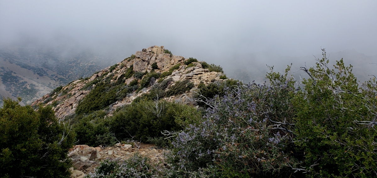
This was truly a bad ass, tough hike. The last 1000 feet to the summit was the toughest. From the Saddle just before the steep ascent was a razor edge ridge that we crossed, followed by more steepness with loose dirt, rocks and some class 2 rock scrambling. Then there was a false summit with a beautiful rock outcropping to climb over. After that is was smooth sailing to the summit through some thick brush.
Despite the thick fog covering what I can imagine would have been beautiful views on the summit, I was so elated. in my opinion this was one tough, bad ass hike. At the top there was two benchmarks and a register.
Descending the steep ridge from the peak was a bit challenging I fell twice because of the loose gravel but i did not seriously get hurt, in fact none of us did. Crossing the razor edge ridge on the descent was more scarier than the ascent.
Anyways, it was a fun day. I'm glad that we all had a successful summit and that we made it out alive, thanks to Keith';s excellent driving skills.
stats: 7 miles, 2500' gain (approximate)